Gran Fondo
start 9.00
start 9.00

![]()
![]()
![]()
![]()
Straight, as the name suggests, all very slightly downhill, the bottom is in good condition.


Starts downhill, after Golf very steep uphill with coarse-grained surface, short paved breaks.
Undulating, good ground, compact earthy, short uphill stretches.
Overall always downhill more or less marked. Compact earthy bottom, short gravel stretches.
First 2 Km uphill with steep slopes followed by a short and steep descent that is quite demanding. Second part for almost 7 Km flat with sometimes coarse-grained surfaces.
Very articulate. Initial ups and downs plus a steep climb with final hairpin bends. Often muddy, gravelly the climb.
Very short stretch. Flat access with final wall with high fences. Good fund.
Very steep climb. Coarse-grained and sometimes muddy ground in the first part. Steep slopes at the start.
Dizzying descent the first half, very steep climb the second. Good fund.
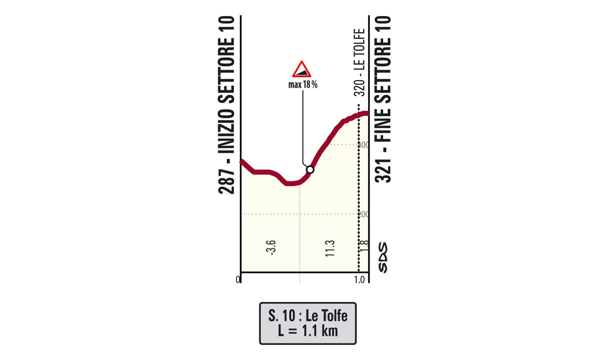
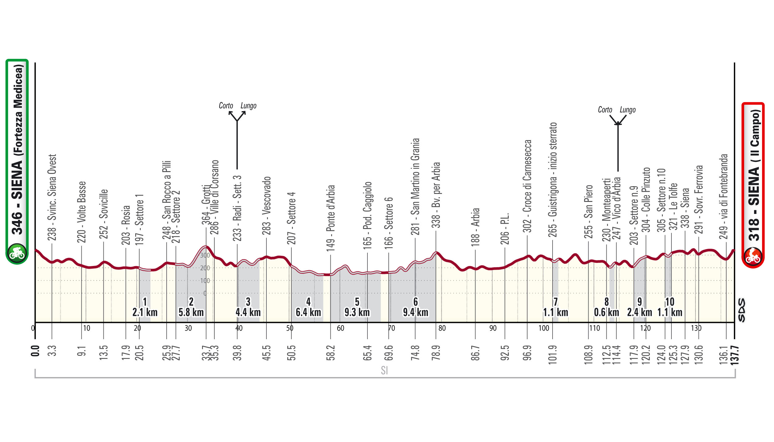
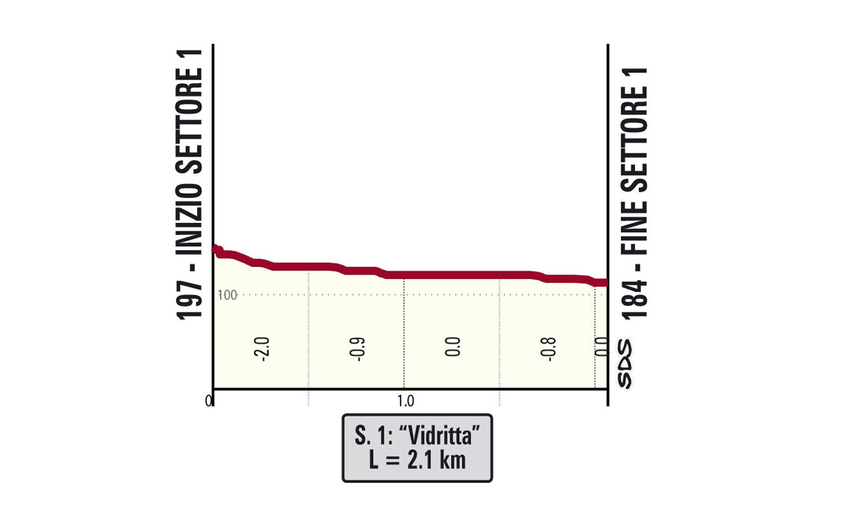
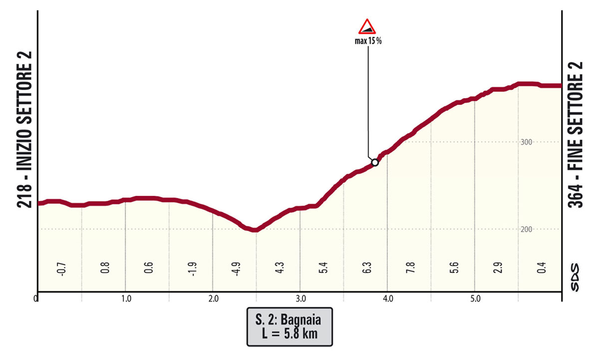
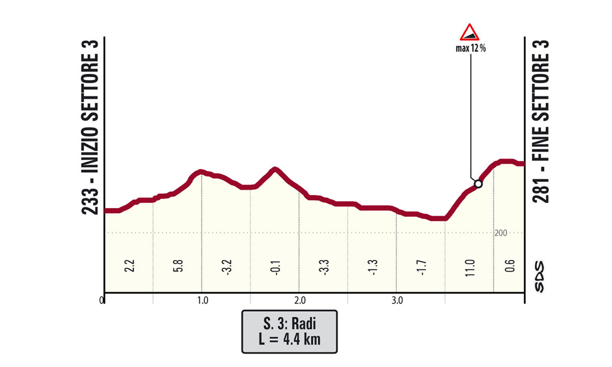
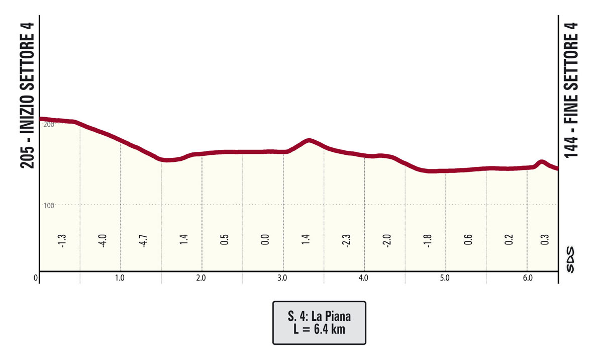
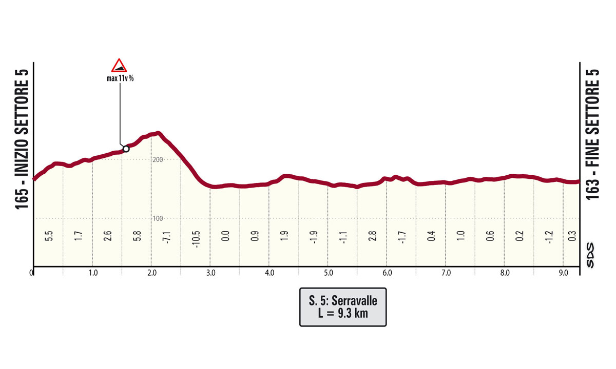
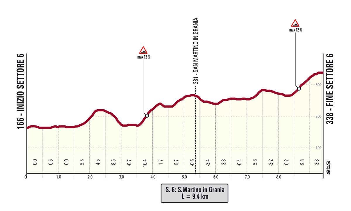
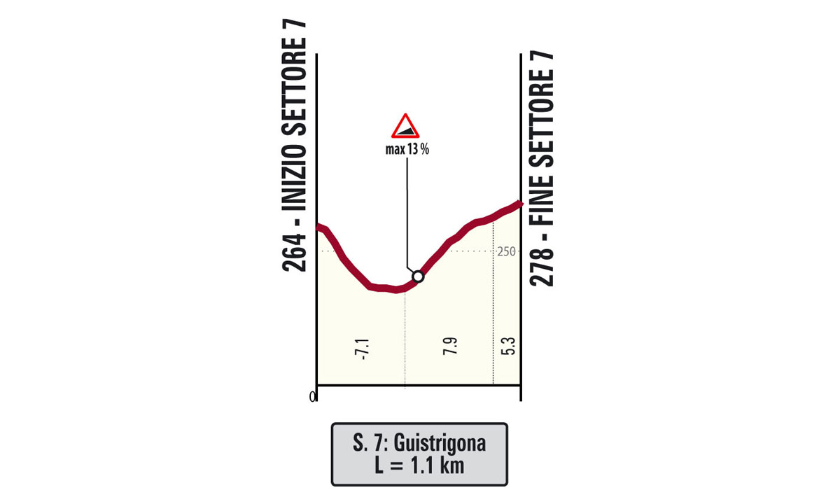
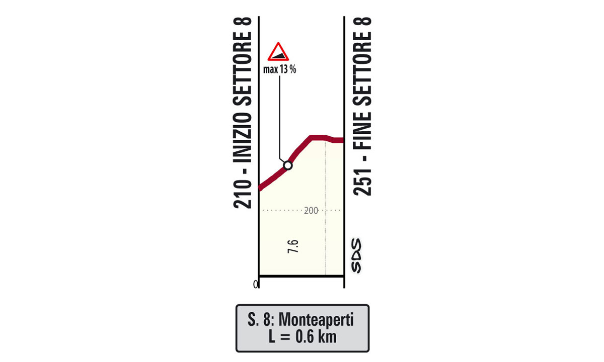
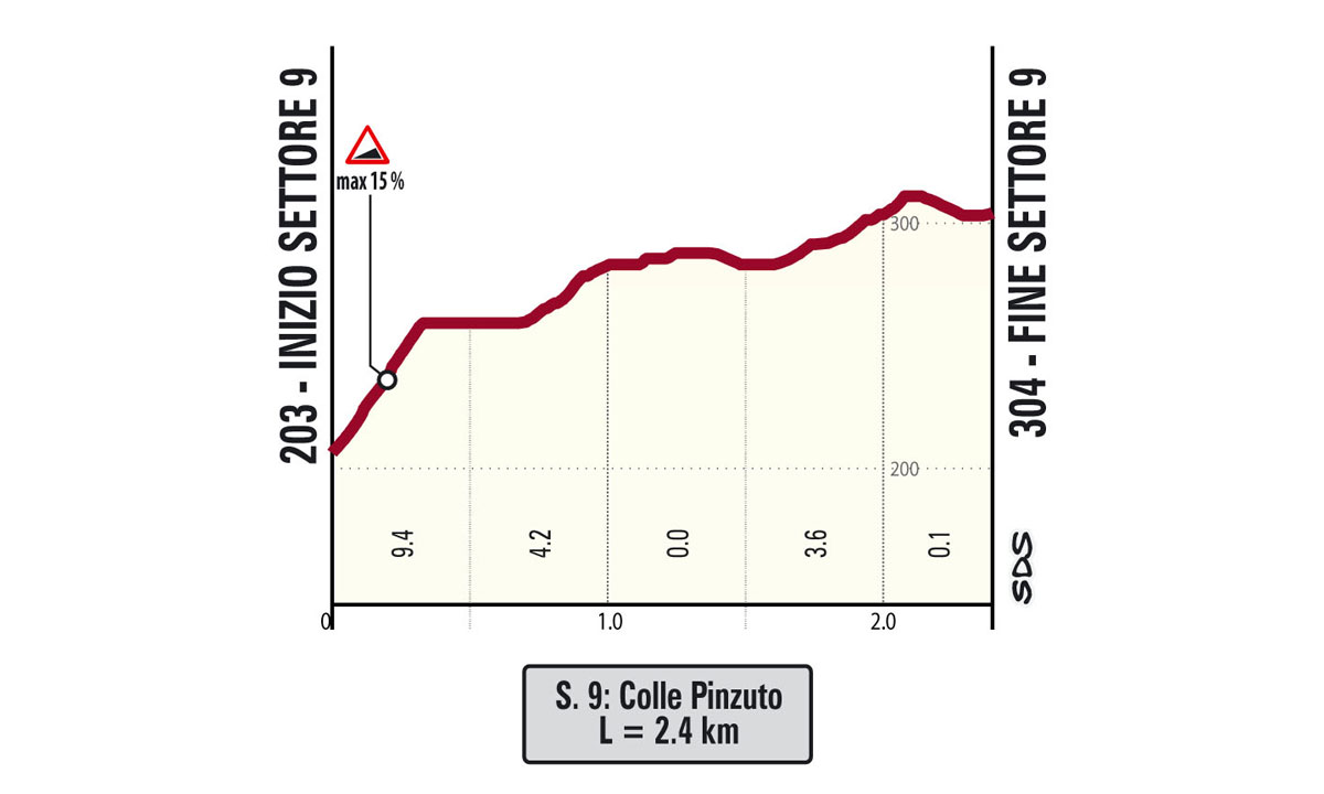
A very bumpy and hilly route, both in planimetric and altimetric terms, without excessively long climbs, but scattered with ups and downs, especially on dirt roads. Approximately 42.6 Km of dirt roads (30.2% of the route) are waiting for the riders. These are divided into 10 sectors (some of which have never been tackled by the Men or Women Élite races) with a well-maintained gravel road surface. After leaving Siena (Stadium/Fortezza Medicea area) and hitting the first hills on asphalt, the riders reach, at Km 20, the 1st unpaved sector (2.1 Km), perfectly straight and constantly slightly uphill. A few more kilometres lead to the 2nd sector (5.8 Km), the first real challenge of the race, featuring a short downhill section and a long uphill one, at times with gradients of around and over 12%. We then reach the village of Radi and the 3rd sector (4.4 Km), immediately followed by the 4th (6.4 Km, the second part is not included in the pro race) which is altimetrically less demanding and leads to Ponte d’Arbia, where we cross the Via Cassia to face the sector of Serravalle, the 5th of the event (9.3 Km, not included in the pro race). This section ends at Monteroni d’Arbia. Barely enough time for a sip of water and the 6th unpaved sector begins, at San Martino in Grania (9.5 Km), in the heart of the Crete Senesi. This is a long gravel section with a succession of relatively light ups and downs in the first part, ending with a steep bendy climb that leads back onto asphalt. This year, there is a new addition: the Guistrigona sector (7th sector, 1.1 km), a slightly uphill gravel section. Next comes the 8 sector, just 600 m long, in Montaperti, but with double-digit gradients along the steep climb. Next comes the asphalt road again, crossing the villlages of Vico d’Arbia and Pieve a Bozzone. The penultimate gravel sector (9th, 2.4 km) climbs Colle Pinzuto with gradients up to 15%. After a few kilometers on asphalt, mostly downhill, the tenth and final gravel sector begins (1.1 km), featuring a sharp descent followed by a steep climb with a maximum gradient of 18%, ending at Le Tolfe. From there, it’s just over 12 km to the finish line in Siena nel Campo.
The final kilometres begin outside the residential area of Siena, on wide roads and long straight sections connected by wide bends, first downhill and then slightly uphill until 2 Km from the finish line, where the Via Esterna di Fontebranda is reached, along with its gradients of up to 9%. At 900 m to go we cross the Porta di Fontebranda, where paved roads begin. The gradient exceeds 10% until reaching peaks of 16% around 500 m from the finish line, in Via Santa Caterina. This is followed by a sharp right turn into Via delle Terme before entering Via Banchi di Sotto. The last 300 m are slightly downhill. At 150 m to go we turn right into Via Rinaldini. At 70 m we enter the Campo: 30 m downhill at 7% and then flat road all the way to the finish line.